A Turkish university inaugurated an exhibition of maps drawn by two Ottoman geographers in the Vatican on Tuesday.
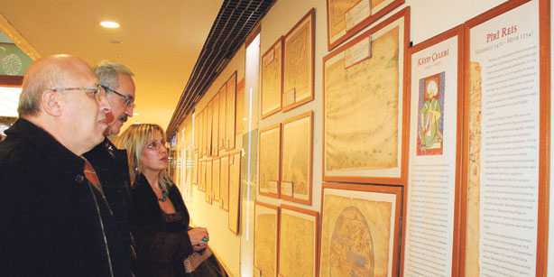
The Civilization Studies Center of İstanbul’s Bahçeşehir University opened “The Ottoman Worldview from Piri Reis to Katip Çelebi” exhibition at the Palazzo della Cancelleria in the Vatican in coordination with Turkey’s Ministry of Culture and Tourism. The exhibition will stay open until Dec. 8.
The exhibition displays reproductions of maps drawn and used during the Ottoman era, until the end of the 17th century. The maps will shed light on the Ottoman worldview. Despite being prepared in the traditional style, the works of Piri Reis are portolan maps based on his personal experience, observations and earlier maps from the East and West. Although they lack longitude and latitude lines, they are as precise as scientific maps for practical naval purposes since they have a projection center and are adjusted for variation.
After the United Nations Educational, Scientific and Cultural Organization (UNESCO) declared 2009 the Year of Katip Çelebi, the exhibition was staged at the California State University at San Bernardino, UNESCO Hall in Paris and the Damascus National Museum as well as in Aleppo and Riga. The exhibition will also be on display in Europe, America, the Middle East and Central Asia in the coming months.
An Ottoman-Turkish geographer and cartographer born between 1465 and 1470 in Gelibolu, in western Turkey, Piri Reis is primarily known today for his maps and charts collected in his “Kitab-ı Bahriye” (Book of Navigation), a book that contains detailed information on navigation as well as extremely accurate charts describing the important ports and cities of the Mediterranean Sea.
He gained fame as a cartographer when a small part of his first world map (prepared in 1513) was discovered in 1929 at Topkapı Palace in İstanbul. The most surprising aspect was the presence of the Americas on an Ottoman map, making it the oldest known Turkish map showing the New World, and one of the oldest maps of America still in existence. (The oldest known map of America that is still extant today is the map drawn by Juan de la Cosa in 1500, which is held by the Naval Museum [Museo Naval] of Madrid.)
The most striking characteristic of the first world map (1513) of Piri Reis, however, is the level of accuracy in positioning the continents (particularly the relation between Africa and South America), which was unparalleled for its time. Even maps drawn decades later did not have such accurate positioning and proportions. In 1528 Piri Reis drew a second world map, of which a small fragment showing Greenland and North America from Labrador and Newfoundland in the north to Florida, Cuba and parts of Central America in the south still survives.
An Ottoman scholar, historian and geographer, Katip Çelebi is known for his encyclopedic contributions, a bibliographical dictionary in the Arabic language, with over 14,500 entries in alphabetical order. This work served as a basis for the “Bibliothèque Orientale” by Barthélemy d’Herbelot de Molainville. He was also the author of many works in the fields of geography, history and economics.
Leave a Reply