In the early hours of 06 February 2023, south eastern Turkey and northern areas of Syria were hit by a powerful and destructive quake. A second one followed only hours later, as well as a series of after shocks. Far away to the west, Istanbul was unaffected; but Turkey’s largest metropolis, lies close to the North Anatolian Fault Zone, one of the most active in the world. Seismologists say the city could be hit at anytime as this documentary, shot in 2019, illustrates.
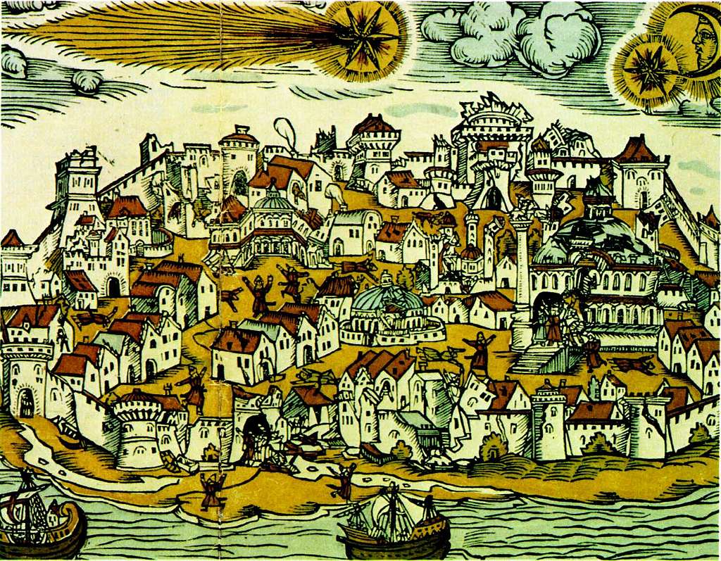
Istanbul comet and earthquake 1556
Marco Bohnhoff is from the German Research Centre for Geosciences in Potsdam. We accompany him and his team on their way to the Princes Islands in the Sea of Marmara just to the south of Istanbul. With the help of several measuring stations, the scientist wants to develop a new type of early warning system for earthquakes in the region. In a best case scenario, it would send warning signals hours or even days in advance. The Anatolian and Eurasian tectonic plates meet directly below the Sea of Marmara, making the risk of earthquakes particularly high. In the case of a big tremor, Turkish disaster management authorities forecast at least 80,000 deaths. In the last few years, the city has been trying to become more earthquake-resistant, for example by tightening building regulations. However, the Chamber of Civil Engineers is skeptical, with chairman Cemal Gökce stressing: Not everything that is new is earthquake-proof. Seismologists such as Marco Bohnhoff, as well as disaster prevention experts and engineers, are working flat out to prepare Istanbul for future natural disasters by constructing special buildings and improving forecasting. [This documentary was filmed in 2019.]
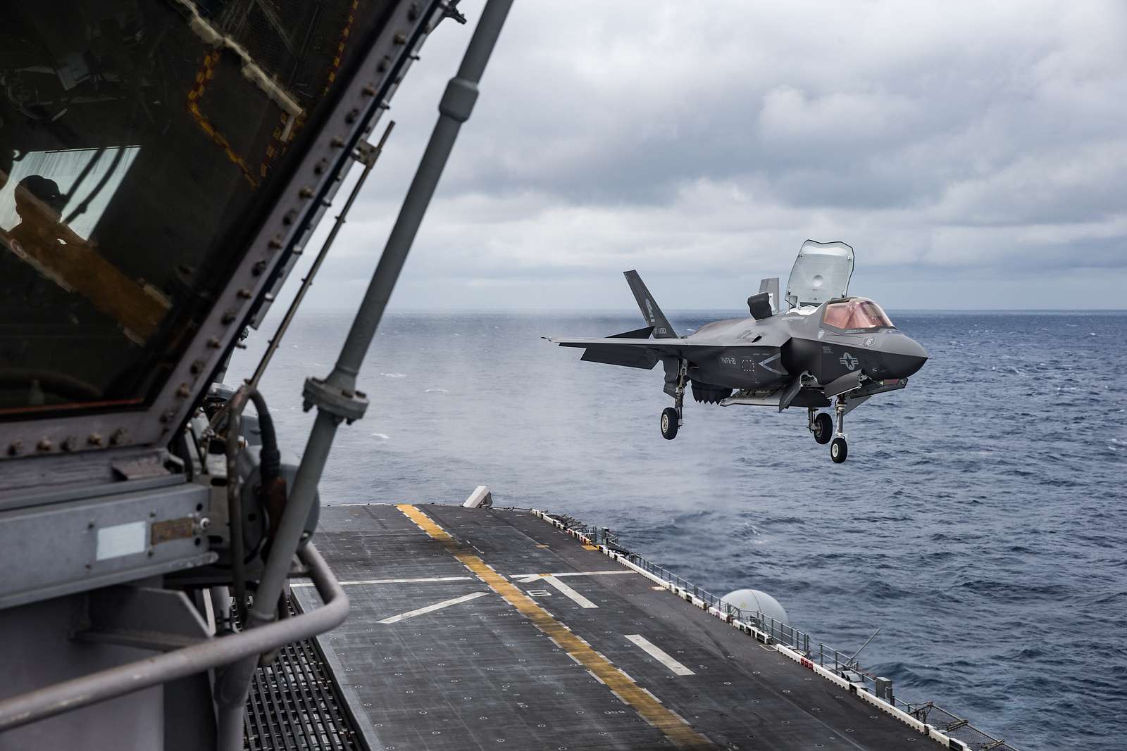
US F-35 shows off its insane vertical takeoff capability
F-35B
Can land vertically like a helicopter and take-off in very short distances. This allows it to operate from austere, short-field bases and a range of air-capable ships. The F-35B is operated by the United States Marine Corps, the United Kingdom, and the Italian Air Force.
Season’s greetings from Istanbul Technical University
Dear Colleagues,
As we are approaching a new year, we are in great excitement. I am proud to announce to you that 2023 marks the 250th anniversary of the founding of Istanbul Technical University (ITU). To highlight this landmark year, we are organizing a series of events including conferences, seminars, concerts and sports activities, publishing books and documentaries. One of our main goals, in this respect, is to bring together our students, graduates, academics, employees, and stakeholders from all around the world to celebrate such a special milestone. I, therefore, warmly invite you to join our celebrations!
As it is well known, bees are the major pollinators of our ecosystem. As a university identifying itself with bees, we continue to pollinate science and technology with more than 250.000 graduates in every part of the world. We are working hard to embrace more and more students each year from diverse countries, making international collaborations with many universities, and striving for the best for the education of our students.
ITU is an institution that guides the engineering education of the future. As a strong partner of the European Engineering Learning Innovation and Science Alliance (EELISA), we are defining a common model of the European engineer for a bright and sustainable society. Connecting campuses from different European countries, EELISA also aims to bring the state-of-the-art research to our students. As a research-intensive university, we contribute to this goal with excellent pioneering research projects recently funded by the European Research Council (ERC). Our academics are shaping the future of engineering with these projects involving our graduate and undergraduate students.
I sincerely wish that the New Year brings health, success, and peace to all my dear colleagues, their families and countries. ITU is always open to new collaborations in order to transform our world into a more sustainable environment.
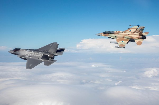
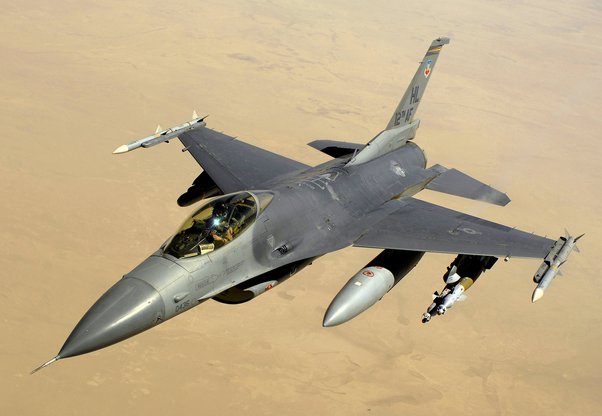
What are the main differences between the F-16, F-22, F-35, and Eurofighter Typhoon?
F-16 : the lightest of the bunch. Single engine multi-role fighter in several generations of upgrades. Nearly 5,000 built. Single air intake underneath the fuselage and one vertical stabilizer along with the main wings and horizontal stabilizers. It probably has the smallest combat radius while having a maximum ordnance load of 17,000 lb. It’s likely the slowest of the 4 as well. Avionics vary by generation but some are getting very advanced upgrades for a light fighter design. A new one will cost you at least $30 million.
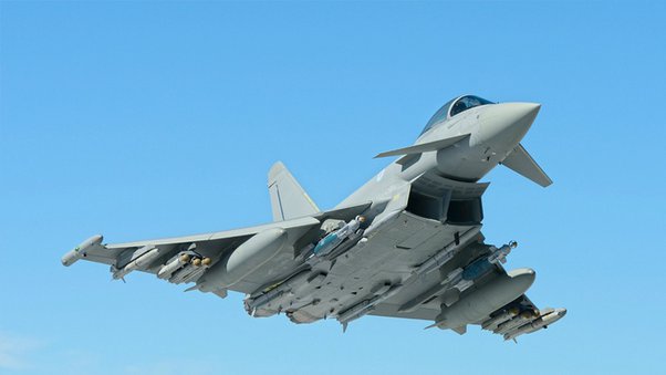
EF-2000 : Second smallest of the bunch and there have been over 500 built. Twin engine multi-role fighter with dual intakes under the fuselage and a delta wing configuration with forward canards and 1 vertical stabilizer. It can reach Mach 2 and supercruise. It is getting an AESA radar upgrade to keep its avionics up to par with others. It has some low-observable considerations in its design but is limited. Its combat radius is a little bit better than the F-16 depending on the ordnance load of which it can carry 19,800 lb total. A new one will cost you around $119 million.
F-35: 2nd largest of the group. Single engine multi-role fighter with air intakes on the sides with conventional wings, horizontal stabilizers and two angled vertical stabilizers. It uses extensive computer modeling for low RCS and also has the most recent RAM (but economic) technology so far. It has an extensive ECM suite, situational awareness system and AESA radar with extensive abilities. It can act as a “mini AWACS” and helps to manage and coordinate the battlefield. It carries a limited strike and air-to-air mix of ordinance internally (about 5,700 lb) and can also carry 15,000 lb of ordnance externally. Its combat radius depending on the variant is as good or better than the previous two with just internal fuel and although not a design requirement it can supercruise in sprints of up to 150 miles. A new A variant will cost you under $90 million, B (VTOL) variant around $115 million and the C (naval) variant around $107 million. There have been over 350 made with plans for close to 3,000 across several countries with the US ordering over 1,000.
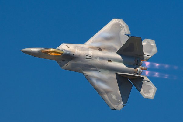
F-22: the largest and most expensive of the group. A twin engine fighter with wings similar to the F-35’s, it is primarily an air dominance fighter with some secondary strike capabilities. It was was designed with an all-aspect attention to RCS reduction and is the hardest to spot on radar or IR of the bunch. It also is utilized as an intelligence platform analyzing and collecting/intercepting signals. Its AESA radar received an upgrade with the abilities of the newer F-35’s radar. This gave it the improved abilities with the ground strike function added as well as upgrades to include battlefield situational awareness management. Its ECM hardware allows it to recognize, triangulate and guide air-to-air missiles without ever turning on its radar. It was the first to achieve supercruise and flies over mach 2. It can do sprints of at least 100 miles in supercruise. It’s intercept range varies on the use of supercruise but can be the furthest of all the jets on internal fuel. It can carry a full air-to-air load of 8 missiles internally or carry 20,000 lb of external ordnance. A new one would have cost about $150 million but the US won’t sell them to anyone. Only 180+ were made and there are no plans for more.
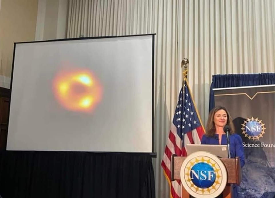
Turkish American scientist and astrophysicist Feryal Özel of University of Arizona today revealed the first images of the black hole of the centre of the Milky Way.
“Until now we didn’t have the direct picture confirming SgrA* was indeed a black hole,” said Professor Feryal Özel of the University of Arizona, during the press conference earlier today.
“This is the first picture of the gentle giant at the centre of our galaxy.” ~ Feryal Özel
Congratulations to Feryal Özel and her amazing colleagues for all their hard work!
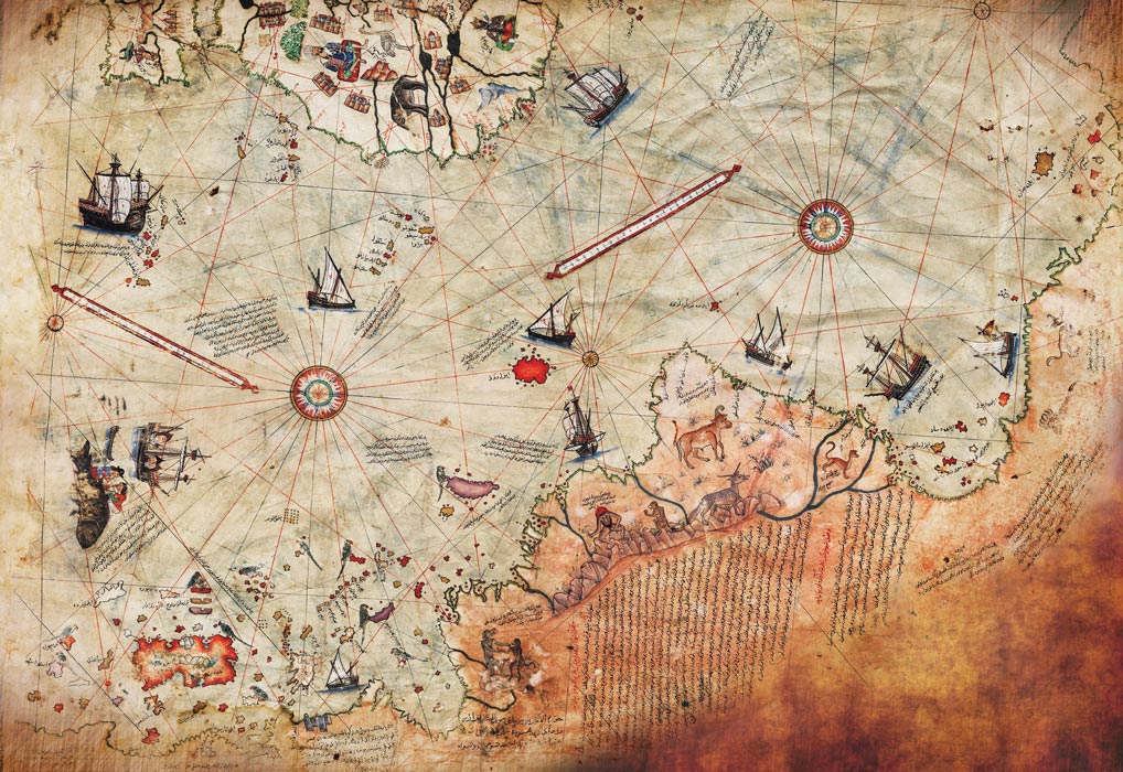
On October 9, 1929, a German theologian named Gustav Adolf Deissmann was cataloguing items in the Topkapi Palace library in Istanbul when he happened across a curious parchment located among some disregarded material. On the gazelle skin parchment was a map, now referred to as the Piri Reis map .
The map was drawn and signed by Turkish cartographer Hagji Ahmed Muhiddin Piri , aka Piri Reis, and is dated to 1513 AD. Reis was an admiral in the Turkish navy, an experienced sailor, and a cartographer, who claimed to have used 20 source maps and charts to construct the map, including 8 Ptolemaic maps, 4 Portuguese maps, an Arabic map, and a map by Christopher Columbus.
Since its discovery, the Piri Reis map has stirred both intrigue and controversy, mostly due to the presence of what appears to be a representation of Antarctica 300 years before it was discovered. Another—if not even more intriguing facet of the appearance of Antarctica—is that it appears to show the land mass before it was covered in ice, over 6000 years ago.
Evidence of Ancient Technology?
The great debate was sparked by Professor Charles Hapgood when he published his theory on the Piri Reis map in his book Maps of the Ancient Sea Kings in 1965. He and a team of students at the University of New Hampshire studied the map and found many anomalies, such as the use of mercatorial projection and the inclusion of a pre-ice Antarctica.
The Greeks were able to create cylindrical maps based on their knowledge of a spherical earth, though mercatorial projection was not used by Europeans until later in the 16 th century, and were also able to use astronomy and geometry to calculate latitude and longitude, though absolute accuracy was not possible until the invention of the chronometer in 1760. While these two feats—amazing as they are—could be explained by use of Greek source maps and charts from the age of Alexander, nothing could explain the inclusion of Antarctica. As a result, Hapgood proposed that the map was based on materials that pre-date 4000 BC, before any known developed languages or progressive civilizations.
This theory implies that a prehistoric civilization had the technology to navigate major seaways and fairly accurately chart the globe. Hapgood also suggested that the topographic depiction of the interior of the continents required aerial capabilities, implying the prehistoric ‘super’ civilization to be both nautical and aerial masters and leading to the further speculation of either an Atlantean or alien civilization. No evidence has been found to support such theories.
South America vs Antarctica
Skeptics of Hapgood’s theory point out that the map is a representation of the South American coastline, pointing to modern physical features of the coast and interior included on the 16 th century map. Otherwise, argue critics, the image would indicate that Antarctica and South America had once been connected at Uruguay, and that Argentina did not yet exist.
While this argument possibly dismisses the presence of Antarctica on the Piri Reis map, other anomalous maps have been found that are identical to the the ice free continent as only 20 th century satellite technology has been able to identify.
Other theories of Hapgood’s have already been dismissed, such as his polar shift theory in which he claimed a sudden shift in the inclination of the Earth’s axis of rotation in 9,500 BC could have resulted in the displacement of Antarctica, sending it hundreds of miles south and resulting in the alteration of its climate from semi-temperate to freezing. All evidence suggests that this shift could not, and did not, occur.
Undiscovered Civilization?
The true question is whether or not Antarctica is the identifiable continent on the Piri Reis map, or any of the other anomalous maps. If it is, could the Piri Reis map have been based on the documents of a yet undiscovered, prehistoric civilization, one that could possess technology enabling them to travel and accurately chart the globe? Regardless of the true origin of the sources, one thing is for certain: this map opens up the debate over how we view our own history and what, if any, of those views are accurate. Perhaps someday the truth will be discovered.